
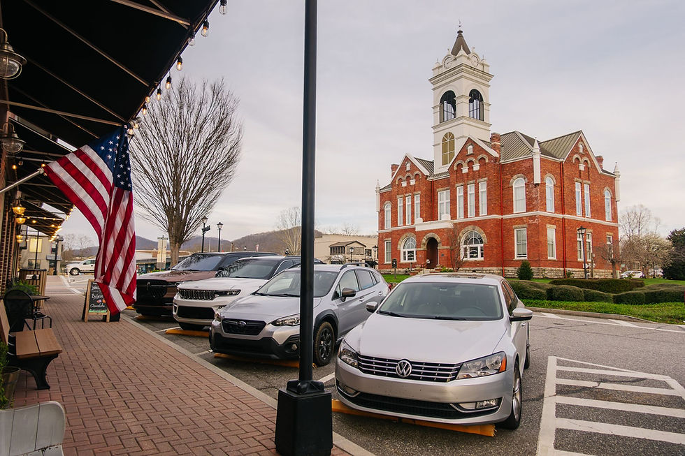
Best Scenic Overlooks and Viewpoints in Blairsville GA: A Visitor's Complete Guide
- Thomas Garner

- 3 days ago
- 24 min read
Updated: 2 days ago

The question visitors ask most often when they arrive in Blairsville isn't about restaurants or shopping or which trail to hike first. It's simpler than that: where do I go to see the mountains? The question sounds basic, but the answer matters more than most people expect — because Blairsville sits at the highest average elevation of any county seat in Georgia, surrounded by ridgelines that stack toward the North Carolina border in overlapping blue-gray waves, and the specific viewpoint you choose determines whether you see the mountains at their most ordinary or at their most extraordinary. A panoramic summit view at 4,784 feet produces a fundamentally different experience than a lakeside sunset from Meeks Park, which produces a fundamentally different experience than a forested ridgeline trail where the canopy opens to reveal a valley you didn't know existed.
Union County has more scenic variety packed into its geography than visitors from Atlanta expect when they make the 90-minute drive north. Brasstown Bald gets the headlines — Georgia's highest point, observation tower, four-state views on clear days. But the overlooks and viewpoints that define the Blairsville experience extend well beyond the summit that appears on every Georgia travel list. Vogel State Park's ridge trails offer elevated views of Nottely Valley that most visitors miss because they never leave the lakeside picnic area. Blood Mountain delivers the most dramatic above-treeline views on the Georgia section of the Appalachian Trail. Track Rock Gap combines mountain scenery with archaeological significance, transforming a roadside stop into something deeper than another photograph. Lake Nottely's western shoreline produces sunset views that visitors from Florida and south Georgia describe as the single most memorable moment of their trip.
This guide covers every significant overlook and viewpoint in the Blairsville corridor — not as a ranked list, but as a seasonal, practical, experience-oriented framework that helps visitors (and the hosts who serve them) understand which views are worth the effort at which times of year, which viewpoints work for families with young children versus experienced hikers, and which scenic experiences produce the kind of emotional response that turns a one-time visitor into someone who comes back every October for the rest of their life.
Brasstown Bald: The Summit That Defines Georgia's Ceiling
Every scenic guide to Blairsville starts with Brasstown Bald, and for once, the conventional wisdom is correct. At 4,784 feet, Brasstown Bald is the highest point in Georgia — not the highest point in the Blairsville area, not the highest peak in the northern part of the state, but the undisputed highest point in the entire state of Georgia. The distinction matters because the summit experience delivers something that no other viewpoint in the Georgia mountains can replicate: a 360-degree panoramic view that extends into four states on clear days. Standing on the observation deck at the summit, you can see into Georgia, North Carolina, Tennessee, and South Carolina simultaneously. The Blue Ridge ridgelines layer toward the horizon in every direction, and on the clearest days — typically late October mornings after a cold front has scrubbed the atmosphere clean — the visibility extends past 80 miles.
The summit is reached via a 0.6-mile paved trail from the parking area, gaining roughly 400 feet of elevation in that short distance. The trail is steep enough that visitors in average fitness will stop once or twice to catch their breath, but it's short enough that families with children over age six manage it without significant difficulty. A shuttle service operates from the parking area for visitors who can't or prefer not to hike the trail — the shuttle runs regularly during peak season and eliminates the physical barrier that would otherwise exclude older visitors and families with very young children from the summit experience. The Forest Service visitor center at the top provides interpretive displays about the Southern Appalachian ecosystem, the Cherokee and Creek peoples who named the mountain (the Cherokee name translates roughly to "place of fresh green"), and the geological processes that pushed these ridgelines to their current elevation over hundreds of millions of years.
The practical details that determine whether a visit to Brasstown Bald is transcendent or frustrating are almost entirely about timing. The parking area fills to capacity on fall foliage weekends — specifically the second and third weekends of October, when the summit's high-elevation foliage has peaked while the surrounding ridgelines display the mid-elevation color transition that creates the layered effect photographers chase. Arriving before 9:00 AM on those weekends is strongly recommended; arriving after 10:30 AM essentially guarantees either a long wait for parking or a disappointed turn away. Weekday visits during foliage season eliminate the parking problem entirely while delivering identical views — a detail STR hosts should explicitly communicate to their guests, because a Tuesday morning summit visit produces the same four-state panorama as a Saturday morning visit without the crowds, parking stress, or shuttle wait.
The seasonal variation at Brasstown Bald is more dramatic than visitors expect. Mid-October delivers the peak foliage views that dominate the social media imagery — the summit's elevation means its foliage peaks two to three weeks earlier than the valley towns below, which creates a timing advantage for visitors who arrive in early-to-mid October rather than waiting for the later foliage peak that lower-elevation markets like Dahlonega or Ellijay experience in late October and early November. Summer visits (June through August) offer lush green ridgeline views under clear skies, but the haze that characterizes Southern Appalachian summers reduces visibility substantially — expect 20 to 40 miles, rather than the 80-plus miles of autumn. Spring visits (April through May) catch the wildflower displays on the lower slopes and the dramatic transition from bare winter ridgelines to the pale green of early leaf-out, which produces a unique color gradient visible from the summit that's available for only about three weeks in late April and early May. Winter visits are possible when the access road is open (it closes during ice and snow events), and they deliver the sharpest visibility of any season — cold, dry winter air regularly produces 100-mile visibility on the clearest days, with leafless deciduous trees creating skeletal ridgeline silhouettes against blue sky that winter landscape photographers specifically seek.
For visitors staying in Blairsville, Brasstown Bald is approximately 20 to 25 minutes by car via GA-180 Spur. The drive itself is scenic — the road climbs through hardwood forest that displays seasonal color transitions in fall — and the approach creates anticipation that the summit view fulfills. Plan 2 to 3 hours for the complete experience: drive, parking, summit hike or shuttle, time at the observation deck and visitor center, and the return. Guests who combine a visit to Brasstown Bald with a stop at Sosebee Cove (described below, located along the same road) create a half-day scenic experience that covers both the highest panoramic viewpoint and one of the finest wildflower coves in the Southern Appalachians.
Vogel State Park: The Scenic Experience Hiding Behind a Picnic Area
Vogel State Park draws 350,000 to 400,000 visitors annually to a 280-acre facility 11 miles south of Blairsville on US-19/129. Most of those visitors come for the lake — Lake Trahlyta's 22 acres of clear mountain water surrounded by forested ridges create the classic north Georgia lake-in-the-mountains scene that appears on state park brochures and tourism websites. Most visitors experience the lakeside picnic areas, the beach, the pedal boats, and the camping facilities. They drive in, set up at the lake, spend the afternoon, and leave, having seen approximately 10 percent of what the park offers in terms of scenery.
The scenic viewpoints that separate a Vogel State Park visit from a pleasant afternoon at a mountain lake are on the trails — specifically the Bear Hair Gap Trail and the Coosa Backcountry Trail, both of which climb the ridgeline above the lake and deliver elevated views across the Nottely Valley that the lakeside visitors never see.
Bear Hair Gap Trail is a 3.3-mile loop that gains approximately 600 feet of elevation from the trailhead near the park office. The trail climbs through mixed hardwood forest — oak, hickory, poplar, with rhododendron understory in the creek sections — and reaches a ridgeline where the canopy thins enough to provide intermittent views northeast toward Blood Mountain and south across the Chestatee River drainage. The views aren't the dramatic four-state panoramas of Brasstown Bald. They're quieter — forest-framed windows into valleys and ridgelines that reveal the scale of the surrounding landscape without the summit-tower perspective that makes Brasstown Bald feel like an observation post. The Bear Hair Gap experience is about walking through the forest and having the mountains appear at intervals as the trail follows the ridge, producing an emotional quality different from the immediate immersion of a summit panorama. Visitors who appreciate the journey as much as the destination — who want to feel the landscape rather than photograph it from above — often describe the Bear Hair Gap ridgeline views as their favorite scenic experience in the Blairsville area, despite (or because of) the effort required to reach them.
The Coosa Backcountry Trail extends the Vogel experience into a longer loop (approximately 12.5 miles total) that penetrates deeper into the backcountry and delivers more sustained ridgeline exposure. This trail is appropriate for experienced hikers comfortable with full-day efforts and moderate elevation changes. The backcountry views include exposed rock outcroppings along the ridgeline, where the surrounding forest drops away and the perspective extends across multiple valleys at once. These are the views that feel earned — they require physical investment that the parking-lot-to-observation-deck experience doesn't, and the relative solitude of the backcountry trail (even on busy park weekends, traffic on the Coosa Trail is a fraction of the lakeside crowds) creates an intimacy with the landscape that crowded viewpoints can't deliver.
For visitors who want the Vogel scenic experience without the commitment of the trail, the recently renovated visitor center (a $4.67 million project completed in August 2025) offers interpretive displays and elevated perspectives from the facility itself. And the drive into the park from Blairsville via US-19/129 passes through forest and mountain scenery that establishes the visual context before the park entrance — particularly in October, when the hardwood canopy along the highway displays the yellow-gold-orange transition that defines north Georgia fall color.
Seasonal guidance for Vogel: summer delivers the best lake-and-mountain combination views (warm light, green forest, blue water, families enjoying the beach creates a scene that feels like a postcard of Southern Appalachian summer), fall delivers the best trail views (the ridgeline sections of Bear Hair Gap in mid-to-late October produce some of the finest foliage perspectives in Union County), and spring delivers the best waterfall and creek scenery as snowmelt and spring rains push water volume through the park's stream systems. Winter visits are quiet — the park is open year-round, but visitor traffic drops substantially from November through March, which means the trails and viewpoints are available with near-solitude that the peak-season visitor doesn't experience.
Blood Mountain: The Appalachian Trail's Georgia Apex
Blood Mountain stands at 4,458 feet — the highest point on the Appalachian Trail in Georgia and one of the most significant hiking destinations in the Southern Appalachian corridor. The summit sits roughly 8 miles south of Blairsville, accessible from multiple trailheads along US-19/129, and offers a mountaintop experience qualitatively different from Brasstown Bald because it's reached exclusively by foot. There's no road to the top, no shuttle, no paved path. Blood Mountain earns its views through physical effort, and the views it delivers reflect that distinction.
The most common approach is from the Byron Reece Trailhead on US-19/129, which provides the shortest route to the summit at approximately 2.1 miles one way with roughly 1,300 feet of elevation gain. The trail is steep in sections, with rocky footing that demands careful foot placement, and the final approach to the summit involves rock scrambling that adds an element of physical engagement beyond standard trail hiking. The effort filters out casual visitors — the summit of Blood Mountain is not a place you end up accidentally, and the people you encounter there have all chosen to be there deliberately.
The summit views reward the effort with exposed rock outcroppings offering 180-degree-plus views across the Georgia Blue Ridge. The southern views look toward Dahlonega and the lower Piedmont, where the mountains visibly flatten as they transition from the Appalachian ridgeline into the Georgia foothills. The northern views look toward the continued Appalachian ridgeline heading into North Carolina. On clear days, the layered ridgeline effect — progressively lighter shades of blue extending toward the horizon — creates the visual depth that landscape photographers call "atmospheric perspective," where each successive ridge appears bluer and more faintly defined until the most distant ridges become indistinguishable from the sky itself.
Blood Mountain's summit also holds the oldest shelter on the Georgia AT — a stone structure built by the Civilian Conservation Corps in the 1930s that provides emergency shelter and historical interest beyond the views themselves. The shelter's presence means Appalachian Trail thru-hikers (primarily northbound in April and May) frequently camp at or near the summit, creating a social dimension to the viewpoint experience that's unique among Blairsville-area overlooks. Visitors who reach the summit during thru-hiker season encounter people who have been walking continuously from Springer Mountain (the southern terminus of the AT, approximately 30 trail miles south) and who are in the early, enthusiastic phase of a six-month, 2,190-mile journey to Maine. The conversation opportunities are memorable in ways that extend beyond scenery.
The timing considerations for Blood Mountain differ from those for Brasstown Bald because the access trail and summit experience are weather-exposed. Summer visits are hot — the trail gains elevation through forest, but the summit is exposed to direct sun, and afternoon thunderstorms are common enough during June through August that an early-morning start (on the trail by 7:00 to 7:30 AM) is strongly recommended for both heat management and storm avoidance. Fall visits combine the best weather (cool temperatures, reduced humidity, lower storm risk) with the best views (foliage on the surrounding ridgelines, clearest atmospheric conditions), making them the optimal time for most visitors. Spring visits coincide with AT thru-hiker season and spring wildflower displays on the lower sections of the trail. Winter visits require cold-weather preparation (summit temperatures can be 15 to 20 degrees Fahrenheit below the Blairsville valley temperature) but deliver extraordinary visibility on clear days and near-complete solitude.
Blood Mountain isn't the right recommendation for every guest. Families with children under ten will find the trail challenging. Visitors with limited hiking experience should be realistic about the elevation gain and rocky terrain. But for guests who are physically capable and interested in earning their views rather than driving to them, Blood Mountain delivers the most emotionally impactful summit experience in the Blairsville corridor — a view that feels personal because the effort to reach it creates a sense of ownership in a way an observation deck cannot.
Lake Nottely: Where the Sunsets Outperform the Postcards
Lake Nottely doesn't appear on most scenic overlook guides because it's a lake, not a mountain, and the convention in Appalachian tourism is that "scenic views" means elevation-based panoramas. This convention misses something important about the Blairsville visual experience: the sunsets over Lake Nottely from the western shoreline are, in the honest assessment of visitors who've seen both the summit panoramas and the lakeside evenings, the single most photographed and most shared scenic moment that the Blairsville area produces.
Lake Nottely is a TVA impoundment on the Nottely River, sitting immediately west of Blairsville with a shoreline that traces through forested hills and rural agricultural land. The lake's western orientation means that sunset light falls directly across the water surface for roughly 90 minutes before dusk during summer months, creating reflected color on the water that amplifies the sky display in ways that mountain summits can't replicate because summits lack the mirror-surface element.
Meeks Park — Union County's developed lakeside recreation area on the eastern shore — provides the most accessible sunset viewing position. The park offers waterfront access, picnic facilities, walking paths, and enough developed infrastructure that visitors of all mobility levels can reach the water's edge comfortably. The sunset view from Meeks Park looks west across the lake toward forested ridgelines that silhouette against the evening sky, and during summer months (when sunset timing aligns with comfortable outdoor temperatures) the park becomes an informal gathering point for visitors and locals watching the light transition.
The kayaking and paddleboarding perspective adds a dimension that shoreline viewing can't match. Visitors who rent or bring watercraft and paddle onto the lake during the sunset hour experience the color display from the water level, surrounded by reflected sky in every direction, with the mountain ridgeline providing a dark foreground frame for the orange-pink-purple gradient. The Nottely River's transition into the lake creates calm water sections where the surface reflection is essentially mirror-perfect on windless evenings — a photographic condition that experienced landscape photographers specifically seek and that casual visitors encounter as an unexpected gift.
Summer evenings are the optimal season for Lake Nottely sunset viewing — the sunset occurs late enough (8:00 to 8:45 PM from June through August) that dinner-and-sunset combinations work logistically, and the warm evening temperatures make lakeside sitting comfortable. Fall sunsets are earlier (6:00 to 7:00 PM in October), but the atmospheric conditions — lower humidity, crisper air, occasional cloud formations from weather systems moving through — produce more dramatic color displays than the relatively consistent summer sunsets. Winter sunsets over Nottely are spectacular but cold, and the early timing (5:30 to 6:00 PM) limits the post-sunset lingering that makes summer lakeside evenings feel expansive.
For STR hosts, the Lake Nottely sunset is one of the most effective experiential recommendations they can offer — it requires zero physical effort, costs nothing, works for every age and fitness level, and produces the kind of moment guests describe in their reviews. Properties with lake views or direct lake access carry a 15 to 25 percent ADR premium, partly because guests associate the lake with the sunset experience even before they arrive. But any host within 10 minutes of the lake can direct guests to Meeks Park with specific timing guidance ("tonight's sunset is at 8:22, you'll want to be at the park by 7:45 to get settled") that transforms a generic recommendation into a curated experience the guest attributes to the host's local knowledge.
Track Rock Gap: Where Scenery Meets Archaeology
Track Rock Gap sits approximately 6 miles southeast of Blairsville at the crest of a Blue Ridge ridgeline, and it delivers something no other viewpoint in the area provides: a scenic experience layered with archaeological significance that transforms mountain viewing from passive observation into active engagement with the landscape's human history.
The gap itself is a natural low point in the ridgeline where ancient travel routes crossed between the Nottely River valley to the north and the valley systems to the south. The views from the gap look north into the broad Nottely Valley, with Blairsville visible in the middle distance and the ridgelines beyond the town stacking toward the Tennessee border. The perspective is different from summit views — instead of looking down at everything from above, Track Rock Gap positions you at ridgeline elevation looking across the landscape at eye level, which creates a relationship with the surrounding mountains that feels lateral rather than hierarchical. The mountains aren't below you; they're beside you, extending at the same height in layered progression.
The archaeological element is what makes Track Rock Gap unique among Blairsville-area viewpoints. Ancient soapstone carvings — petroglyphs created by indigenous peoples, likely Cherokee or pre-Cherokee inhabitants, over thousands of years — are preserved at the gap and designated as a National Historic Landmark. The carvings include circles, crosses, animal tracks, and other symbolic forms whose precise meaning is debated among archaeologists but whose presence confirms that this ridgeline crossing has been a significant landscape feature for human beings long before European settlement, long before Georgia became a state, and long before the concept of "scenic overlooks" existed as a tourism category.
Standing at Track Rock Gap with the Nottely Valley spread before you, and the petroglyphs at your feet, creates an experience that connects the act of looking at mountains to the history of people looking at these same mountains across millennia. The scenic dimension and the historical dimension reinforce each other — the view helps you understand why this gap was significant to the people who carved the stone, and the carvings help you understand that the mountains you're seeing have been watched, valued, and traveled through by human beings for far longer than the human mind comfortably comprehends.
The visit itself is brief — Track Rock Gap is a roadside stop accessible from Track Rock Gap Road (Forest Service Road) without significant hiking. Visitors can experience the viewpoint and the petroglyphs in 20 to 40 minutes, making it an excellent complement to other Blairsville scenic destinations. The gap pairs naturally with Brasstown Bald (roughly 15 minutes further up GA-180) or with Sosebee Cove (in the same general direction), creating a scenic loop that covers summit panoramas, ridgeline perspectives, archaeological history, and wildflower ecology in a single half-day circuit.
Fall timing produces the strongest visual experience at Track Rock Gap because the Nottely Valley's hardwood forests display their color transition in the middle distance while the ridgelines beyond the valley show progressively different foliage timing at different elevations — a vertical stratification of autumn color that's visible from the gap's lateral perspective in ways that summit views compress. Spring visits add wildflower interest to the surrounding forest. Summer visits are comfortable but visually less dramatic. Winter visits provide the clearest atmospheric conditions and the starkest ridgeline silhouettes.
Sosebee Cove: The Viewpoint That Looks Down Instead of Out
Sosebee Cove Scenic Area sits a few miles south of Brasstown Bald along GA-180, and it represents a category of scenic experience that most visitors don't think to seek: the downward view into an old-growth wildflower cove rather than the outward view across a mountain panorama. It's one of the finest old-growth wildflower coves remaining in Georgia, and the scenic quality isn't about distance or breadth — it's about intimacy, detail, and the experience of standing among ancient trees in a landscape that hasn't been logged, cleared, or developed.
Want to know what's holding your listing back? Get a free STR visibility audit.
The cove contains large-diameter yellow poplars (tulip trees) and buckeyes that have grown to full maturity in the protected microclimate of the cove's natural bowl shape — the surrounding ridgeline shelters the cove from the wind exposure that limits tree growth at higher elevations, and the north-facing orientation retains moisture that supports the wildflower displays that are the cove's primary scenic attraction.
The wildflower season at Sosebee Cove runs from mid-April through late May, with peak display typically in the first two weeks of May. During peak bloom, the forest floor is carpeted with trillium, lady slippers, jack-in-the-pulpit, Solomon's seal, wild geranium, and dozens of other native wildflower species that grow in profusion because the old-growth canopy creates the filtered-light conditions they require. The visual effect is a forest floor that appears painted — dense patches of white, pink, purple, and green creating a ground-level color display that contrasts with the dark trunks of the mature trees and the filtered sunlight coming through the canopy above.
A short interpretive trail (approximately 0.3 miles) loops through the cove with informational signs identifying plant species and explaining the ecology that produces the wildflower displays. The trail is accessible to visitors of essentially all fitness levels — it's flat, well-maintained, and short enough that families with strollers and visitors with mobility limitations can complete it comfortably. The accessibility makes Sosebee Cove one of the most inclusive scenic experiences in the Blairsville area — no summit hike required, no steep trails, no physical barriers between the visitor and the experience.
The scenic value of Sosebee Cove lies in looking closely rather than far. Visitors conditioned to associate "scenic" with "panoramic" sometimes arrive at the cove, look around, and wonder where the view is. The view is under their feet and at eye level — the wildflowers, the old-growth tree trunks, the filtered light, the forest ecology visible in miniature if you slow down enough to observe it. Photographers who work at Sosebee Cove switch from wide-angle landscape lenses to macro lenses, which says everything about the kind of seeing the cove rewards.
Timing guidance for Sosebee Cove is more specific than for other Blairsville viewpoints because the wildflower display is genuinely ephemeral. The first two weeks of May are the peak window in most years, though weather variation can shift the peak by a week in either direction. Visitors who arrive outside the wildflower window still experience the old-growth forest (which is impressive year-round), but they miss the ground-level color display that makes the cove a destination rather than a pleasant forest walk. Fall visits add the canopy color transition, with the large-diameter poplars turning gold overhead while the forest floor displays the brown-and-gold palette of fallen leaves. Winter visits offer the clearest views of the tree architecture itself — trunk structure, bark patterns, branching forms — that leaf cover obscures during the growing season.
Duncan Ridge Trail: The Ridgeline Walk That Rewards Experienced Hikers
The Duncan Ridge Trail runs along a high ridgeline south of Blairsville, providing sustained elevated views toward Blood Mountain and across the broader Blue Ridge corridor. The trail is accessed from Mulky Gap on Forest Service Road 39 and extends for approximately 18 miles through the Chattahoochee National Forest, though day-hiking sections of 4 to 8 miles capture the best viewpoint segments without requiring a multi-day commitment.
The ridgeline walking experience on Duncan Ridge differs from summit viewpoints because the views are continuous rather than concentrated at a single point. Instead of hiking to a destination where the view reveals itself, the Duncan Ridge hiker walks along the view — the ridgeline exposure means that scenic perspectives open and close repeatedly as the trail follows the undulating spine of the ridge, with each high point offering a slightly different angle on the surrounding valley and mountain landscape. The effect is cinematic rather than photographic — the view evolves over time rather than presenting itself as a single composition.
The sections south of Mulky Gap toward Coosa Bald provide the most accessible ridgeline views for day hikers. Coosa Bald's summit (4,280 feet) is reached in approximately 3 miles from the trailhead and delivers open views across the Nottely River drainage to the north and the Chestatee drainage to the south. The trail between Mulky Gap and Coosa Bald traverses several exposed rock outcroppings where the canopy drops away, and the ridgeline perspective extends to the horizon — these natural viewpoints are spaced closely enough that the hiker experiences a new panorama every 15 to 30 minutes of walking.
Duncan Ridge is not a trail for casual or beginner hikers. The elevation changes are sustained (expect 500 to 800 feet of gain and loss per mile on the more rugged sections), the footing includes rocky sections that require attention, and the trail's relative remoteness means that cell service is absent along most of the ridgeline, so self-sufficiency is expected. Adequate water, appropriate footwear, and awareness of weather conditions (the exposed ridgeline offers no shelter during thunderstorms) are essential, not optional.
For hikers prepared for it, though, Duncan Ridge delivers the most sustained ridgeline scenic experience in the Blairsville corridor. The combination of physical engagement, solitude (the trail sees substantially less traffic than Blood Mountain or the Vogel State Park trails), and continuous panoramic exposure creates an experience that serious hikers describe as the reason they return to Blairsville season after season. The fall foliage views from the Duncan Ridge ridgeline — looking down into coves and across valleys where the color transition is visible at multiple elevations simultaneously — are among the finest in north Georgia for hikers willing to put in the effort to reach them.
DeSoto Falls and Helton Creek Falls: The Waterfall Viewpoints
Not all scenic experiences in the Blairsville corridor involve mountain panoramas. Two waterfall destinations within easy driving distance of town offer vertical perspectives that complement the horizontal ridgeline views from the summits and trails described above.
DeSoto Falls, located approximately 15 miles south of Blairsville along US-129, features upper and lower waterfall sections accessible via a 2-mile round-trip trail through mixed hardwood forest. The lower falls drop approximately 35 feet into a pool surrounded by rhododendron and hemlock, creating an enclosed forest-and-water scene that feels intimate compared to the expansive mountain panoramas available elsewhere. The upper falls are taller and more dramatic, reached by a steeper trail section that adds moderate effort to the visit. The combined waterfall experience takes 1.5 to 2.5 hours and works well as a morning activity before an afternoon summit visit or lakeside evening.
The scenic quality of DeSoto Falls lies in the water, light, and the enclosed forest atmosphere that surrounds the falls. Morning visits (before 11:00 AM) provide the best photographic conditions because the morning light reaches the lower falls at an angle that illuminates the water spray without creating the harsh contrast that midday direct sunlight produces. After rain events, the water volume increases substantially, and the falls become more dramatic — visitors who time their DeSoto Falls visit for the day after a rain system passes through the area see significantly more impressive water displays than visitors who arrive during extended dry periods.
Helton Creek Falls is closer to Blairsville (about 8 miles south on Helton Creek Road) and offers a shorter, more accessible waterfall experience. The trail is approximately 0.4 miles round trip — short enough for families with young children and visitors with limited mobility — and leads to a dual waterfall where two separate cascades are visible from a single viewing area. The upper falls drop approximately 50 feet while the lower falls create a broader cascade over rock ledges. The viewing area is close enough to the falls that visitors feel the mist on warm days, which adds a sensory dimension beyond the visual experience.
Helton Creek Falls is particularly effective as a quick scenic stop during the summer months, when the mist provides natural cooling, and the forest canopy surrounding the falls creates shade that makes the waterfall viewing area comfortable even during the warmest afternoons. The accessibility and brevity of the visit make it one of the best scenic recommendations for families with young children who can't commit to summit hikes or extended trail walks — the payoff-to-effort ratio at Helton Creek Falls is the highest of any Blairsville scenic destination.
Both waterfall destinations display seasonal variation: spring provides the highest water volume (snowmelt and rain), summer provides the lushest surrounding forest vegetation, fall adds canopy color to the forest frame above the falls, and winter (when deciduous trees are bare) reveals more of the rock structure and allows more light to reach the falls, creating a starker and more sculptural visual quality. The waterfalls are accessible year-round, though trail conditions during winter ice events may require caution.
The Scenic Driving Loop That Ties Everything Together
For visitors who want to experience multiple Blairsville viewpoints in a single day without committing to extended hiking, a scenic driving loop connects several of the key viewpoints in a circuit that takes 4 to 6 hours, depending on how long you spend at each stop. The loop works as a self-guided tour that STR hosts can provide as a printed or digital guide — and in the Crest & Cove research data, hosts who provide specific routing guidance (rather than generic "go see Brasstown Bald" recommendations) generate meaningfully stronger guest reviews because the structured experience reduces the decision fatigue that visitors feel when they arrive in an unfamiliar mountain destination with too many options and too little local knowledge.
The optimal loop route from Blairsville:
Start by driving south on US-19/129 toward Vogel State Park. Stop at the park for the lakeside views and, if time and fitness permit, the Bear Hair Gap Trail for ridgeline perspectives. Continue south on US-19/129 to the DeSoto Falls Recreation Area for the waterfall experience (1.5 to 2 hours). Return north to the GA-180 junction and turn east toward Brasstown Bald. Stop at Sosebee Cove (20 to 40 minutes for the wildflower trail) before continuing to the Brasstown Bald parking area and summit (2 to 3 hours, including shuttle or hike). On the return, take Track Rock Gap Road north to visit the petroglyphs and ridgeline viewpoint (20 to 40 minutes). Return to Blairsville and, if timing aligns with sunset (check the time before departing for the loop), finish at Meeks Park on Lake Nottely for the evening light display.
This loop covers six distinct scenic experiences — lakeside, ridgeline trail, waterfall, old-growth cove, summit panorama, archaeological viewpoint — plus the sunset finish if timing cooperates. The variety ensures that visitors who complete the loop have experienced the full range of what Blairsville's landscape offers rather than concentrating exclusively on the summit experience that most tourism guides emphasize.
Seasonal modifications to the loop: in spring, prioritize Sosebee Cove early in the day when the wildflowers are at their best and the morning light is gentlest. In summer, schedule the Brasstown Bald visit for early morning (before haze builds), and the DeSoto Falls visit for midday (when the forest shade is most welcome). In the fall, visit Brasstown Bald for early morning when the foliage light is warmest, and the parking competition is lowest, and reserve Track Rock Gap for late afternoon when the low-angle light illuminates the Nottely Valley views from the gap most dramatically. In winter, reverse the loop to catch morning light on Lake Nottely (winter sunrise over the lake can be as dramatic as summer sunset) and finish with Brasstown Bald in the afternoon when winter light creates the longest shadows on the ridgelines.
What the Scenic Calendar Means for Hosts Who Serve Visitors
The scenic viewpoints in the Blairsville corridor don't just exist as attractions — they function as demand drivers that shape the market's entire visitor economy. The relationship between scenic experiences and STR performance is direct: guests come to Blairsville to see the mountains, and the quality of the scenic experience they have determines whether they leave a five-star review, whether they return next season, and whether they tell friends and family to book the same property.
The seasonal scenic calendar aligns closely with the STR market's demand patterns. October — when Brasstown Bald's summit foliage peaks, the Bear Hair Gap ridgeline displays its finest colors, Track Rock Gap's valley views show layered autumn color, and Lake Nottely's sunsets benefit from the atmosphere's clearest seasonal conditions — is the single highest-demand month in the Blairsville STR market. ADR premiums of 35 to 45 percent above the annual baseline, occupancy approaching 85 to 95 percent for well-positioned properties, and 60-to-90-day advance booking windows all reflect the scenic experience that October delivers. Guests booking October visits aren't coming for restaurants or shopping — they're coming for the views, and the entire economic cycle of the market's highest-revenue month rests on the scenic assets described in this guide.
The summer demand period (June through August) aligns with the lake recreation and family hiking season — guests are booking for Vogel State Park access, Lake Nottely water recreation, waterfall visits, and the general mountain-escape-from-Atlanta motivation that Blairsville's 90-minute proximity to the metro makes possible for weekend trips. Summer occupancy runs 70 to 80 percent for quality properties with ADR premiums of 20 to 25 percent above the annual average, reflecting the sustained but less intense demand that summer's scenic offerings produce relative to fall's concentrated peak.
Spring's scenic assets — Sosebee Cove wildflowers, AT thru-hiker energy, fresh green ridgeline transitions, high waterfall volumes at DeSoto and Helton Creek — create a shoulder season with meaningful demand that hosts who recognize and market the spring scenic experience capture more effectively than hosts who treat everything between winter and summer as generic shoulder months. Properties whose listings mention spring wildflower proximity, AT hiker-friendly amenities, or waterfall access capture the spring demand segment more effectively than properties offering generic "mountain getaway" positioning.
Winter's scenic assets are real but niche — the extraordinary visibility on cold, clear days, the skeletal ridgeline beauty, the solitude of trails and viewpoints that are crowded in other seasons. The winter market runs at 35 to 45 percent occupancy, and the hosts who capture the winter visitors who do come are the ones who position their properties for the specific scenic experience winter provides: cozy cabins with mountain views, hot tubs for post-hike warming, fireplaces for evening ambiance, and guest guides that communicate winter's unique scenic advantages rather than treating the season as something to endure between October and April.
The operational takeaway for hosts: the scenic viewpoints in this guide aren't just nice things to recommend to guests. They're the reason guests come. Understanding which viewpoints serve which guest segments, which seasons produce the strongest scenic experiences at each location, and which combination of viewpoints creates the full-day experiences that produce five-star reviews — this understanding is what separates the hosts generating $40,000 or more annually from the hosts generating $22,000 with comparable properties in comparable locations. The scenic assets are identical across all hosts. The difference is whether the host understands those assets well enough to connect them to the guest's experience in ways that produce the emotional resonance that drives reviews, repeat visits, and referrals.
In a market where 80 percent of hosts have zero web presence beyond their platform listing, the host who provides a printed scenic driving guide, who texts their guest the sunset time at Lake Nottely, who recommends Sosebee Cove during the specific two-week wildflower peak, who warns about Brasstown Bald parking on Saturday mornings — that host is delivering a level of local expertise that most competitors can't match because they haven't invested the attention required to understand what their guests actually came to see.
Start with a free visibility audit at crestcove.co/audit.

Comments