
When Drone Photos Actually Sell a Short-Term Rental

Updated: Aug 27
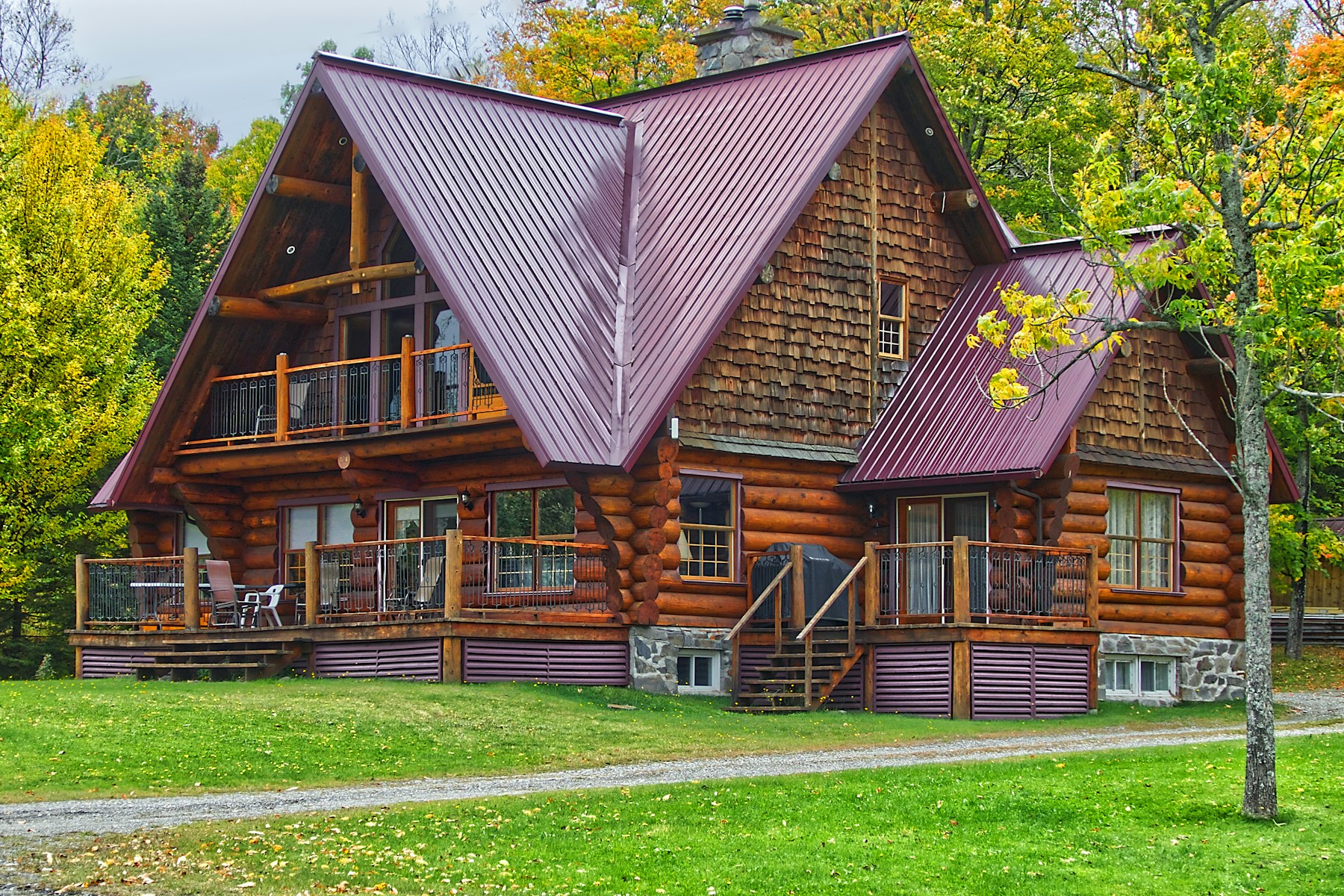
Drone photography has become an easy add-on for listing photo shoots, and an easy way to spend money on footage that does not actually help a guest decide to book. An aerial view is dramatic, but drama is not the same thing as information, and a gallery led entirely by rooftop shots tells a guest almost nothing about the bed they will sleep in or the bathroom they will use.
The right question for any host considering drone footage is not whether it looks impressive, but whether it answers a real guest question the ground-level photos cannot. How close is the water actually? What does the true lot size look like from above? What is the approach a stranger will drive when arriving after dark? Those are legitimate uses. A generic aerial establishing shot with no ground-level context is not.
This piece covers when aerial footage genuinely earns its place in a listing gallery, when it does not, and the legal and privacy constraints a host needs to check before hiring anyone to fly a drone over their own property or the properties nearby. This is not legal advice.
When Drone Footage Actually Adds Value
Drone footage earns its place when it answers a specific guest question that ground-level photography genuinely cannot: how close the water actually is compared to what the listing description claims, what the true shape and size of the lot looks like, or the exact approach a stranger will need to drive or walk to reach the property after dark. Those are concrete, bookable pieces of information, not decoration.
A drone shot with no ground-level context, an aerial-only gallery, or a listing that leads with rooftop and treeline images before showing a single interior room, tells a guest almost nothing about what they are actually paying for. Guests book based on what a room, bed, and bathroom look like first; the setting is context that supports that decision, not a substitute for it.
The test worth applying before commissioning any aerial shoot is simple: name the specific question this footage will answer that a ground-level photo set cannot. If there is a clear answer, waterfront proximity, a large or unusually shaped lot, a genuinely hard-to-describe approach, the shoot is likely worth the cost. If the honest answer is just "it looks nice," that budget is probably better spent on stronger interior photography instead.
Drone Footage Should Supplement, Never Replace, Ground-Level Photos
Drone footage should supplement ground-level photography, not replace it. Guests are booking a specific room, a specific bed, a specific bathroom, and an aerial view provides context for the property's setting, not a substitute for proving the interior actually matches what the listing promises. A gallery led entirely by aerial shots reads, fairly or not, as a listing that may be hiding something about the rooms themselves.
In practice, this means the lead image in search results should almost always be the strongest ground-level or interior shot available, not the drone footage. Guests scroll quickly through search results, and that first image needs to sell the actual room, not the roofline or the surrounding tree canopy. A drone shot belongs further into the gallery, positioned as context after the interior has already made its case.
This ordering is not a minor styling preference. A listing that opens with an aerial view is spending its single most valuable piece of visual real estate, the first photo a guest sees, on information that does not directly answer the question a guest is actually trying to answer: will I be comfortable in this specific room.
Legal Constraints Before Flying a Drone Over a Property
FAA Part 107 rules govern commercial drone operation in the United States, and altitude, airspace, and registration requirements can apply even for a single listing photo shoot. A host hiring a photographer should confirm that photographer holds a current, valid certification rather than assuming any camera-equipped drone flight is automatically legal simply because it is happening over private property.
Flying without the proper certification can expose both the photographer and the host to real liability, not just a hypothetical compliance risk. A host is not automatically shielded from consequences just because a hired contractor was the one operating the drone; getting proof of certification in writing before the shoot protects both parties.
It is also worth checking local restrictions that sit on top of federal rules: a homeowners association, a local ordinance, or proximity to a park or protected land can all restrict or outright ban drone flights independent of what the FAA otherwise permits. Confirming these local rules before scheduling a shoot avoids paying for footage that legally cannot be used, or cannot be captured at all.
Privacy Constraints Near Neighboring Properties
A drone flight that captures a neighbor's yard, pool, or windows raises real privacy concerns even when the operator's intent is only to photograph the subject property. Aerial footage has a wider field of view than most photographers account for in advance, and an otherwise well-intentioned shoot can easily sweep in far more of the surrounding neighborhood than anyone planned to capture.
Framing shots tightly to the listing's own property boundary, and avoiding extended hover time directly over adjacent homes, keeps the footage focused on what it is actually meant to sell while reducing the chance of an uncomfortable conversation with a neighbor afterward. This is a straightforward instruction to give any photographer before a shoot, not an afterthought to address if a complaint comes in.
A complaint from a neighbor over an intrusive flight can cost a host more goodwill, and in some cases more legal exposure, than the footage itself is worth. That risk is easy to avoid with clear framing instructions given upfront, and it is worth treating as a standard part of any drone shoot briefing rather than something left to a photographer's individual judgment.
Not Every Property Benefits From an Aerial Shot
A small in-town lot with little visible from above beyond rooftops and a driveway gains almost nothing from an aerial shot, and the cost and added complexity of arranging a drone flight is not justified there. Waterfront properties, large-acreage listings, or genuinely remote-access homes are where an aerial view actually helps a guest understand the setting before booking in a way ground photos alone cannot.
For a host with a limited photography budget, the honest first question is not whether drone footage would be nice to have, but whether the lot itself has a story worth telling from above. If it does not, that budget is almost always better spent strengthening ground-level and interior photography first, since that is what most guests are actually evaluating when they decide whether to book.
This is also a useful filter for evaluating a photographer's pitch. A photographer who recommends drone footage for every property regardless of lot size or setting is applying a one-size-fits-all upsell, not tailoring the shoot to what this specific listing actually needs to sell itself effectively.
What to Ask a Drone Photographer Before Booking
Ask directly whether the photographer holds a current FAA Part 107 certificate and liability insurance, and ask to see prior work on properties genuinely similar to the one being shot, not a generic aerial highlight reel that could belong to any property anywhere. A photographer who cannot answer basic licensing questions clearly and confidently is a compliance risk the host inherits, not just a quality risk.
Get the certificate and insurance confirmation in writing before the shoot takes place, not after footage has already been delivered. This is a small amount of upfront friction that meaningfully reduces a host's exposure if something goes wrong during the flight, whether that is a mechanical failure, an airspace violation, or a neighbor complaint.
It is also reasonable to ask the photographer directly what specific guest question the planned shots are meant to answer. A photographer who can articulate that clearly, this angle shows the actual walk from the dock, this shot proves the true distance to the water, is demonstrating the same discipline a host should be applying to their own listing copy.
How Drone Footage Should Be Labeled in a Listing
An aerial shot should be labeled for what it actually is, a setting or context photo, rather than left to imply a proximity or scale it does not genuinely show. A wide-angle aerial view can make a beach, a lake, or a downtown district look closer than it actually is, and that kind of visual exaggeration tends to become a review complaint rather than a booking win.
A guest who books partly on the strength of an aerial view that made the water look closer than it truly is will notice the gap the moment they arrive, and that gap is exactly the kind of accuracy complaint that erodes trust in a listing over time, even when every individual photo was technically real and unedited.
The safer approach is straightforward captioning: identify what the shot shows and roughly how far it actually is from the property, rather than letting the image speak for itself and hoping a guest infers something more favorable than what is true. Accuracy in captioning costs nothing and prevents a specific, recurring kind of guest disappointment.
This same discipline applies to video, not just still photography. A slow aerial pan that lingers on the water before cutting to the house can visually imply a walking distance that does not match reality, even if no caption ever states a false number outright. If a guest would reasonably watch a clip and come away with a wrong impression of distance, the fix is either a caption correcting it or a re-edit that does not create the false impression in the first place.
Building a Realistic Photo Budget Around This Decision
For most independent hosts, the more valuable investment is a strong, complete ground-level photo set: every bedroom, every bathroom, the kitchen, the outdoor living space, and a handful of images that show the specific details a guest cares about most, natural light, storage space, the actual view from inside rather than above. Drone footage, when it is warranted at all, should be treated as a smaller supplemental line item on top of that foundation, not a substitute for it.
A host weighing whether to add drone footage to a photo budget should ask the same question posed earlier: what specific guest question will this footage answer? If the property is waterfront, large-acreage, or has a genuinely notable approach, that question likely has a real answer, and the additional cost is reasonable. If the honest answer is closer to "it would look impressive," that money is very often better spent elsewhere.
This is also a decision worth revisiting over time rather than treating as permanent. A property that did not initially seem to warrant aerial footage might genuinely benefit from it after a property change, a new dock, a cleared view, a completed landscaping project, just as a property that once justified the expense might not need it repeated on every future photo refresh.
None of this needs to become an expensive, ongoing subscription-style photography arrangement to be effective. A single, well-planned drone session tied to a specific, documented reason, paired with a strong ground-level set updated whenever the property genuinely changes, does more for a listing's booking rate than a recurring aerial package that keeps reshooting a lot whose shape has not changed at all.
Related Reading
More independent-host reading on honest listing copy, distribution, and when hiring help is worth it.
Frequently Asked Questions
When does drone footage actually add value to a short-term rental listing?
When it answers a real guest question the ground-level photos cannot, how close the water actually is, what the true lot size looks like, or the approach a stranger will drive. A drone shot with no ground-level context, like an aerial-only gallery, tells a guest almost nothing about the actual rooms they will sleep in.
Should drone footage ever replace ground-level photos?
No. Drone footage should supplement ground-level photos, not replace them. Guests book based on what a room, bed, and bathroom actually look like; an aerial view is context for the property's setting, not a substitute for proving the interior matches what is promised. A gallery led entirely by aerial shots reads as a listing hiding something about the rooms themselves.
What legal constraints should a host check before flying a drone over their own property?
FAA Part 107 rules govern commercial drone operation in the U.S., and altitude, airspace, and registration requirements can apply even for a single listing shoot. A host hiring a photographer should confirm that photographer is a licensed, insured operator rather than assuming any camera-equipped drone flight is automatically legal. Flying without the right certification can expose both the photographer and the host to real liability.
What privacy issues come up with drone photography near other properties?
A drone flight that captures a neighbor's yard, pool, or windows raises real privacy concerns even when the intent is only to photograph the subject property. Framing shots tightly to the listing's own boundary, and avoiding hover time directly over adjacent homes, keeps the footage focused on what it is actually meant to sell. A complaint from a neighbor over an intrusive flight can cost more goodwill than the footage is worth.
Are there properties where drone footage doesn't make sense?
Yes. A small in-town lot with little visible from above beyond rooftops gains little from an aerial shot, and the cost and complexity of a drone flight is not justified there. Waterfront, large-acreage, or remote-access properties are where an aerial view genuinely helps a guest understand the setting before booking. Spend the budget on ground-level photography first if the lot itself does not have a story to tell from above.
Does a drone shot help more than a good first ground-level photo?
No, and it should not be positioned to compete with one. The first photo a guest sees in search results should be the strongest ground-level or interior shot; a drone shot belongs further into the gallery as context, not as the lead image trying to do a first photo's job. Guests scroll fast, and the lead image needs to sell the room, not the roofline.
What should a host ask a drone photographer before booking?
Ask whether they hold a current FAA Part 107 certificate and liability insurance, and ask to see prior work on similar properties rather than a generic aerial reel. A photographer who cannot answer basic licensing questions is a compliance risk the host inherits, not just a quality one. Get the certificate and insurance confirmation in writing before the shoot, not after.
Can a homeowners association or park restrict drone flights over a rental property?
Yes, in many cases. HOA rules, local ordinances, and proximity to parks or protected land can all restrict or ban drone flights independent of FAA rules. Confirming local restrictions before scheduling a shoot avoids paying for footage that cannot legally be captured or used.
How should drone footage be captioned or labeled in a listing?
Label an aerial shot for what it is, a setting or context photo, rather than letting it imply proximity or scale it does not actually show. A guest who books based on an aerial view that made the beach look closer than it is will notice the gap on arrival, and that gap shows up in reviews.
How much of a listing's photo budget should go toward drone footage?
For most properties, the majority of any photo budget is better spent on a complete, strong ground-level photo set covering every room. Drone footage should be a smaller supplemental expense reserved for waterfront, large-acreage, or genuinely hard-to-describe approach situations, not an automatic add-on for every listing.
Should a host revisit the drone-footage decision after property changes?
Yes. A property that did not initially need aerial footage may benefit from it after a change like a new dock or a cleared view, and a property that once justified the expense may not need it repeated on every future photo refresh. Treat the decision as tied to the property's current setting, not a one-time or permanent call.
Work with Crest & Cove Creative
A drone shot only earns its place when it answers a real guest question, access, parking, the approach. A gallery led by an aerial view with no ground-level proof wastes the diligence guests do before booking.
We use drone footage only where it proves something guests actually need, and pair it with strong ground-level photos of the real rooms. Start at crestcove.co or call (256) 998-7502. Send the live listing draft and the facts you can actually cite.
Reach out at crestcove.co or (256) 998-7502.


Comments