
Foothills Parkway and Look Rock: The Overlooks Page for Walland Hosts

Updated: Aug 28
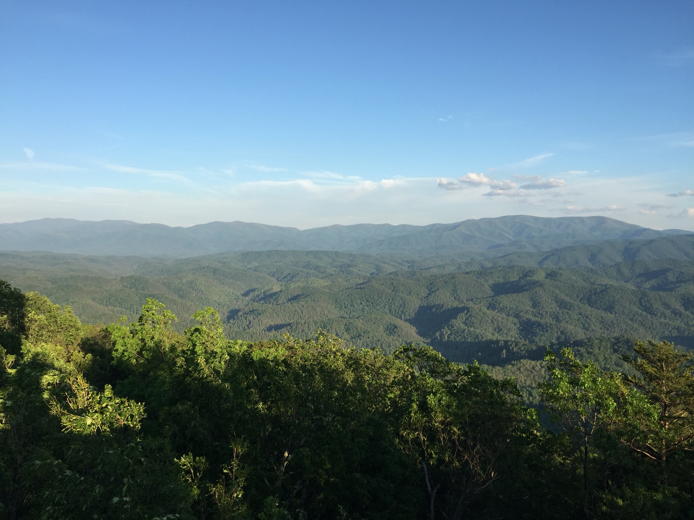
The Parkway literally ends at Walland. That is why this page exists, and why it is not a Cades Cove rewrite. Foothills Parkway from Chilhowee Lake on US-129 to US-321 near Walland is 16.6 miles one-way. The National Park Service counts sixteen parking areas and fourteen overlooks on that section. Mileposts count from Chilhowee. Look Rock is mile 7.1: a lower viewing platform reached by stairs from the lot, plus the Look Rock Tower Trail. Mile 7.5 is the picnic area and campground, with restrooms in season. This is the scenic product a Walland listing can actually name.
Guests who booked a Quiet Side cabin did not ask for a Gatlinburg overlook list. They asked for the ridge they can reach before breakfast. Southeast overlooks on the south end face the mountains around Cades Cove at sunrise. North-end southeast overlooks look into Millers Cove farms. Northwest overlooks can see the Cumberland Plateau on a clear day. There is no vehicle reservation on this drive. Most pull-offs have no trash cans. Pack out what you brought. Pets stay on roads, picnic areas, and the campground. They do not go on most park trails.
Thecomplete visitor’s guideis the three-day spine. TheKnoxville weekendis the Friday drive. This page is only Chilhowee to Walland, Look Rock, and one honest paragraph on the separate 14.75-mile Walland-to-Wears Valley section before this file stops. Cades Cove is a different road and a different morning — open theCove timingpost. Little River and US-321 are the street the cabin sits on — open theriver drive. Do not mash those jobs into one overlooks essay.
Chilhowee to Walland is 16.6 miles
Start at US-129 / Chilhowee Lake if you want the mileposts to match the NPS drive page. End at US-321 near Walland. Sixteen parking areas. Fourteen of them are overlooks. The count is the Park Service’s, not a blog passport of pretty views. Drive the section. Use the paved pull-offs. Do not invent a fifteenth named overlook this draft did not lock. Do not invent a vehicle reservation. The road is a scenic parkway, not a timed-entry product and not the Tail of the Dragon. Some drivers continue toward US-129 at the south end. That is a different ride. One sentence is enough.
Hosts should sell this drive as the house-view or the ten-minute ridge, not as a day that also swallows Cades Cove. Guests who try to collect every pull-off before lunch will photograph fog and miss the porch they paid for. Pick a direction. If you slept in Walland, you can enter from the US-321 end and still reach Look Rock without treating the full 16.6 miles as a death march. If you want sunrise on the south-end southeast overlooks, leave in the dark and confirm Maps. October leaf is the honest peak language for this ridge. July humidity is a different photograph.
This cluster will not borrow a Blue Ridge Parkway essay or a North Georgia overlook list. Walland is the pin. Foothills Parkway West is the named road. Thewho bookspage already gave this drive to Persona A — the sunrise guest who wants Look Rock, not a loop of historic cabins. Write the listing that way. Photograph first light from a pull-off you have actually stood in. A stock ridge from another county is how a Quiet Side cabin starts lying in frame one.
Look Rock is mile 7.1
Prefer the Chilhowee-to-Walland drive page for the milepost. Look Rock is mile 7.1 on that count. The lot serves a lower viewing platform reached by stairs and the Look Rock Tower Trail, a 0.8-mile paved round-trip the Park Service calls mild-to-moderate. The ramp to the tower is steep. Pets are not allowed on this trail. A parking tag is required if you stay longer than 15 minutes. The tower trail page also mentions a trailhead between mile markers 14 and 15 on Foothills Parkway West — a different milepost count. Do not invent a third number. Use mile 7.1 from the Chilhowee-origin drive page and send guests to the live NPS trail page the week they walk.
The lower platform is the shorter stop. The tower is the walk. Tell guests which one they came for before they park. A guest who expected a curb-level view and met a steep ramp will write the review about stairs, not about fog. A guest who expected a long hike and met 0.8 paved miles will wonder why you sold a mountain. Mild-to-moderate is the Park Service grade. Steep is the ramp sentence. Keep both. Do not call it easy. Do not call it a backcountry climb.
Look Rock is the named tower on this cluster’s scenic page. It is not Cades Cove. It is not a substitute for the 11-mile loop. It is not a pet hike. If the house promised a dog-friendly ridge morning, the honest product is a pull-off on the parkway road, the picnic area, or the campground — not the tower trail. Send theCades Cove morningonly when the guest actually wants the loop. Keep Look Rock on this page so the ridge and the loop stay different jobs.
Mile 7.5, restrooms, and the pack-out rule
Mile 7.5 is Look Rock Picnic Area and Campground. Restrooms are seasonal. Confirm the live campground and picnic pages the week you go. Most overlook pull-offs do not have trash cans. Pack out what you brought. That sentence belongs in the house manual next to the parking-tag basket. A cabin that sends guests onto Foothills without a bag plan is training a review about a full lot and a wrapper in the grass. The Park Service already said pack out. Repeat it.
The campground also has a parking-tag machine, which is useful when the Welcome Center is closed and the guest already drove past Townsend. A tag still does not guarantee a space. Picnic tables and restrooms in season are the comfort layer. They are not a reason to treat mile 7.5 as a second town. Overnight camping is a reservation product on the NPS campground page. This overlooks file will not rebuild a campground manual. Point at the official page. Then bring people back to the Walland cabin they booked.
Hosts should photograph picnic-area frames only if the guest can actually reach them on the dates accepted. Visitors should not treat a closed seasonal restroom as a broken parkway. Shoulder months on the AirROI file — January, February, and April — can mean earlier light and quieter pull-offs. October can mean a thicker ridge. Both clocks are still Foothills. Theshoulderpost owns the host calendar. This page only needs the visitor half: restrooms when they are open, pack out always, and do not leave food for wildlife at a pull-off that never had a can. Seasonal silence is not a broken park.
What the overlooks actually face
Southeast overlooks on the south end of this section face the mountains around Cades Cove at sunrise. That is a view of the Cove basin from the parkway, not a substitute for driving the loop. North-end southeast overlooks look into Millers Cove farms — the same cove language a Walland listing already sells as the cabin setting. Northwest overlooks can see the Cumberland Plateau on a clear day. Those three facing sentences are the NPS drive page. They are enough. This file will not invent ten pretty names for the same ridge.
Sunrise language belongs to the south-end southeast pull-offs and to guests who will actually leave in the dark. A noon arrival from Knoxville on a Friday is not a sunrise product. Open theweekendpage for that clock. Leaf language belongs to October. Clear winter mornings can be honest on this ridge when the road is open and the guest packed for cold. July haze is a different frame. Do not promise the Plateau if the day is socked in. Do not promise Cades Cove wildlife from a Foothills railing.
Listing copy should pick one facing sentence that matches the house. A Miller’s Cove cabin can say the north-end overlooks look back into the farms. A guest who booked for Cades Cove sunrise still needs the loop page, not a railing photograph. Thehow to marketpost already refused Dollywood copy. This page supplies the nouns that replace it: Chilhowee to Walland, 16.6 miles, Look Rock at mile 7.1, Millers Cove farms, Cumberland Plateau on a clear day.
Pets stay on the road
Pets are allowed on roads, in picnic areas, and in the campground. They are not allowed on most park trails, including the Look Rock Tower Trail. The two national-park trails that do allow pets are Gatlinburg Trail and Oconaluftee. Those are not this drive. This page will not send a Walland guest across the park to walk a dog. If the listing sold a dog-friendly Quiet Side morning, the honest walk is a parkway pull-off, a picnic-area loop you can confirm, or a leash on the cabin road. It is not a tower hike.
Write the house manual in that order. Leash. Road and picnic only. No tower. Pack out waste with the rest of the trash, because most pull-offs have no cans. A guest who reads “pet friendly Smokies” and then meets a closed trail at Look Rock will blame the cabin. A guest who reads the actual NPS pets rule will take the dog to breakfast light on a railing and be fine. Do not invent a third pet trail. Do not paste a Gatlinburg-side tip onto a Walland pin. The card should be short enough to read in the car before the first pull-off.
Hosts who take dogs should photograph the porch and the parkway pull-off, not the tower boardwalk with a leash in frame. Visitors who need a long trail with a dog should understand they are booking a different product than this overlooks page defends. Keep the rule short enough to text on Friday night. Keep Gatlinburg Trail and Oconaluftee off the card. Those names belong to other sides of the park. Walland’s card is Foothills roads, picnic, campground, pack out. That is the whole pet sentence this drive will carry.
The parking tag on a Foothills pull-off
A parking tag is required to park anywhere in Great Smoky Mountains National Park longer than 15 minutes. Daily is $5. Weekly is $15. Annual is $40. Confirm those dollars on the NPS fees page the week you stay — the page this draft used was updated 7 July 2026. The tag is physical and plate-matched. A screenshot is not accepted. It is not replaceable, refundable, or transferable. America the Beautiful, Senior, Access, and Military passes do not replace it. Disability placards and plates are exempt. A tag does not guarantee a space.
Quiet-Side purchase points that actually serve this drive include the Great Smokies Welcome Center at 7929 E. Lamar Alexander Parkway in Townsend, the Townsend Wye machine, Tremont, the Cades Cove Visitor Center and Orientation Shelter machines if the guest is already that far east, and a machine at Look Rock Campground. Online daily and weekly tags are recreation.gov activity pass AP2510 and must be printed. Tell Friday arrivals to buy before the first 16-minute overlook, not after the ranger has already walked the lot.
Put a printed tag note in the cabin next to the weekend order of operations. Saturday sunrise at Look Rock is one product. Saturday at Cades Cove open is another. Either way the tag is the same rule. Hosts who skip the basket are training a fine on day one. Visitors who thought the America the Beautiful pass covered the parkway will learn it does not. This page will not invent a reservation for the overlooks. There is none. Buy the tag before the first long stop.
Walland to Wears Valley is 14.75 miles, then stop
Foothills Parkway from Walland to Wears Valley is a separate NPS thing-to-do at 14.75 miles. That is the whole geographic fact this cluster will carry. It is not a Wears Valley file. It is not a reason to rewrite this hamlet as a Sevier approach. One paragraph of distance, then stop treating Wears Valley as a sibling town. Guests who want that section can drive it from the Walland end and come back to the cabin they booked. Hosts should not caption a Walland porch as Wears Valley because the parkway keeps going.
This page will not open a Wears Valley cluster, will not borrow Sevier factory language, and will not send the Saturday to Pigeon Forge because the ridge continued east. Walland is unincorporated Blount. The pin stays here. If a guest asks what is past the Walland entrance, you may say 14.75 miles of Foothills toward Wears Valley and then bring them home. That is enough. The complete guide already refused to become a second-town brochure. This overlooks page follows the same stop. Distance is not a license to rename the hamlet.
Photograph the Walland end. Write the Chilhowee-to-Walland mileposts. Name Look Rock at 7.1. Leave Wears Valley as a distance, not a market. A listing that leans on the next valley to fill a calendar is already training the wrong guest. A visitor who booked Walland and then spent the day collecting another county’s overlooks is already writing a different trip than this page defends. 14.75 miles. One paragraph. Then the pin is Walland again. Do not let the parkway’s next entrance rename the hamlet you are paying for.
Cades Cove and Little River are different jobs
Cades Cove is a different road and a different morning. The loop is 11 miles, one-way, sunrise to sunset, and needs two to four hours when you can drive it. Wednesdays from 6 May through 30 September 2026 are vehicle-free all day. That operations clock lives on theCades Covepage. This overlooks file will not rebuild it. When the loop is bikes, or when the morning lot is already turning cars, Foothills and Look Rock are the scenic-drive alternative — one honest paragraph there, then stop. Do not mash both encyclopedias into one Saturday.
Little River and US-321 are the street Walland sits on. Miller’s Cove is the cabin setting. The Townsend Wye is a swim-and-tube pull-off with a parking-tag machine. That drive lives on theLittle Riverpage. This file will not rebuild a put-in guide or a Townsend lunch list. Blackberry Farm is a hotel on the same state highway — one sentence, not a view product. Maryville coffee and Townsend lunch stay unsourced by name unless a business page is in front of you. Keep the river on its page and the ridge on this one.
Saturday from Knoxville holds one ridge product or one Cove product, not both as a death march. Open the weekend page for the Friday clock and the Sunday reverse. Open thecomplete guideif you kept a third night. This page’s job is narrower: 16.6 miles, sixteen lots, fourteen overlooks, Look Rock at mile 7.1, a steep tower ramp, seasonal restrooms at 7.5, pack out, pets on the road, a parking tag, and 14.75 miles toward Wears Valley before the file stops. Confirm NPS pages the week you drive. Then come back to Walland.
Related Reading
More Walland, Blount County, Foothills Parkway, and Quiet Side reading already live on Crest & Cove.
The Quiet Side Cabin Market: Walland TN Short-Term Rental Report 2026
Walland STR Rules: Blount County, Townsend, and the Maryville Ban
DIY vs Hire in Walland: Photos and Craft on a 45-Listing Hamlet
Is a Property Manager Worth It in Walland? Independent Hosts on the Quiet Side
Is Walland a Good Short-Term Rental Investment in 2026? One Unit at $3,050
Walland's Shoulder Season: January, February, and April Between Three Peaks
Who Books a Walland Cabin: Foothills Sunrise, Cades Cove Morning, Blackberry Road
Blount County Tourism Spending and Walland Hosts: What the TDTD Number Measures
Financing a Walland Cabin: DSCR vs Second-Home on $3,050 and 37% Occupancy
A Walland Weekend From Knoxville: US-129, US-321, and Friday at 5
A Cades Cove Morning From Walland: Vehicle-Free Wednesdays and the Parking Tag
Little River and US-321: The Quiet Side Drive From a Walland Cabin
Frequently Asked Questions
How long is Foothills Parkway from Chilhowee to Walland?
16.6 miles one-way, from US-129 / Chilhowee Lake to US-321 near Walland. The Park Service counts sixteen parking areas and fourteen overlooks. Mileposts count from Chilhowee. There is no vehicle reservation. Most pull-offs have no trash cans. Confirm the live NPS drive page the week you go. The National Park Service counts sixteen parking areas and fourteen overlooks on that section.
Where is Look Rock on this drive?
Mile 7.1 on the Chilhowee-to-Walland count. The lot serves a lower platform reached by stairs and the Look Rock Tower Trail, a 0.8-mile paved round-trip. The ramp to the tower is steep. Pets are not allowed on this trail. Do not invent a third milepost. The lot serves a lower viewing platform reached by stairs and the Look Rock Tower Trail, a 0.8-mile paved round-trip the Park Service calls mild-to-moderate.
Are pets allowed at Look Rock?
Pets may use roads, picnic areas, and the campground. They may not use the Look Rock Tower Trail or most park trails. Gatlinburg Trail and Oconaluftee allow pets — those are not a Walland tip and this page will not send you there. There are no trash cans at most pull-offs. They are not allowed on most park trails, including the Look Rock Tower Trail.
Do I need a parking tag on Foothills pull-offs?
Yes, to park anywhere in the national park longer than 15 minutes. Daily $5, weekly $15, annual $40 on the NPS fees page this draft used. The tag is physical and plate-matched. America the Beautiful does not replace it. Disability placards are exempt. Look Rock Campground has a machine. A parking tag is required to park anywhere in Great Smoky Mountains National Park longer than 15 minutes.
What do the overlooks actually face?
South-end southeast overlooks face the mountains around Cades Cove at sunrise. North-end southeast overlooks look into Millers Cove farms. Northwest overlooks can see the Cumberland Plateau on a clear day. Those are NPS facing sentences. This page will not invent a list of ten pretty names. Southeast overlooks on the south end of this section face the mountains around Cades Cove at sunrise.
Is the Walland-to-Wears Valley parkway part of this page?
Only as 14.75 miles, then stop. It is a separate NPS thing-to-do. This cluster will not become a Wears Valley file and will not send Saturday to Pigeon Forge because the ridge continues. Come back to the Walland cabin you booked. Distance is not a license to rename the hamlet. This page will not open a Wears Valley cluster, will not borrow Sevier factory language, and will not send the Saturday to Pigeon Forge because the ridge continued east.
Is this the Cades Cove page?
Cades Cove is a different road, an 11-mile loop, and a different morning, including vehicle-free Wednesdays 6 May–30 September 2026. Open the Cades Cove sibling. When the loop is bikes or the lot is turning cars, Foothills is the scenic alternative — then stop. When the loop is bikes, or when the morning lot is already turning cars, Foothills and Look Rock are the scenic-drive alternative — one honest paragraph there, then stop.
Where are restrooms on this section?
Mile 7.5 is Look Rock Picnic Area and Campground, with seasonal restrooms. Confirm the live NPS picnic and campground pages. Most overlook pull-offs have no restrooms and no trash cans. Overnight camping is a reservation product on the official campground page, not this overlooks essay. This page’s job is narrower: 16.6 miles, sixteen lots, fourteen overlooks, Look Rock at mile 7.1, a steep tower ramp, seasonal restrooms at 7.5, pack out, pets on the road, a parking tag, and 14.75 miles toward Wears Valley before the file stops.
Do short-term rental licenses transfer with the deed?
Do not invent a town permit fee this page did not confirm. This page will not invent a reservation for the overlooks. Visitors who need a long trail with a dog should understand they are booking a different product than this overlooks page defends.
Work with Crest & Cove Creative
Need the Foothills and Look Rock page that actually ends at Walland?
Reach out at crestcove.co or (256) 998-7502.


Comments