
Dahlonega Overlooks: What to Put in the Listing for Independent Hosts

Updated: Aug 28

Dahlonega sits at approximately 1,450 feet in Lumpkin County, Georgia, lower than most of the north Georgia mountain towns that get scenic overlook coverage, and with a character defined more by rolling vineyards and gold rush history than by dramatic summit views. That combination leads most travel guides to skip Dahlonega entirely when listing scenic viewpoints, defaulting instead to Brasstown Bald or the Blue Ridge corridor for their north Georgia recommendations.
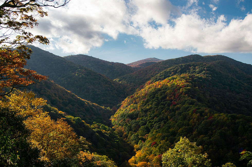
That's a mistake. Dahlonega's viewshed is different from that of higher-elevation destinations — not lesser, but different, in a way that rewards visitors who understand what they're looking at. The landscape surrounding Dahlonega transitions from the Georgia Piedmont to the southern edge of the Blue Ridge, producing a terrain of long ridgelines, vineyard-covered slopes, wide valley views, and forest-to-farmland mosaics that create a visual character closer to wine country than to alpine wilderness. For the right guest — the one who appreciates a vineyard panorama as much as a summit view, or who finds beauty in a river valley seen from a ridgeline at golden hour — Dahlonega's overlooks are among the most rewarding and least crowded in north Georgia.
This guide covers every major viewpoint accessible from a Dahlonega base, from the high-country summits within an hour's drive to the pastoral ridge views and vineyard overlooks within minutes of town.
Understanding Dahlonega's Landscape: The Piedmont-to-Blue Ridge Transition
The most useful thing to understand about Dahlonega's viewshed is the geographic context that makes it distinctive. The town sits at the southern edge of the Blue Ridge physiographic province — the zone where the Appalachian mountain chain gives way to the rolling Piedmont plateau that extends south toward Atlanta. This transition zone is visible from elevated positions around Dahlonega as a gradual change in terrain character: forested ridgelines to the north and east, with the terrain softening and flattening to the south and west as the mountains yield to the foothills.
This transition creates a visual diversity that pure mountain markets don't offer. From a single elevated viewpoint above Dahlonega, a visitor can see Blue Ridge mountain terrain to the north, the vineyard-covered middle elevations of the Dahlonega Plateau directly below, and the Piedmont horizon fading into the distance to the south. That layered composition — mountains, wine country, and foothills visible simultaneously — is genuinely unique to the Dahlonega area and gives its overlooks a character that can't be found at higher-elevation destinations where the view in every direction is more forest ridgeline.
The Dahlonega Plateau AVA — the American Viticultural Area that encompasses the vineyard country surrounding the town — adds another visual layer. Vineyards on south-facing slopes, with their ordered rows and seasonal color changes, create a managed landscape element within the mountain terrain that reads as distinctly Mediterranean from elevated viewpoints. Fall in Dahlonega means not just forest foliage turning on the ridgelines but also grape harvest activity in the vineyards below — a dual-season visual unique in the Georgia mountain context.
Springer Mountain: The Appalachian Trail's Southern Terminus
Springer Mountain, at 3,782 feet, approximately 20 miles north of Dahlonega via GA-60 and USFS roads, holds a unique position in American hiking culture as the southern terminus of the Appalachian Trail. The bronze plaque marking the AT's beginning — or end, depending on your perspective — sits on the summit, and the mountain draws both through-hikers beginning their northbound journey and day visitors making a pilgrimage to the trail's starting point.
The Summit and Approach Views
Springer Mountain's summit is forested, with limited views from the ground level. The most rewarding viewpoints along the approach are found on the AT and the Benton MacKaye Trail in the miles leading to the summit, where periodic ridge openings provide views south toward Dahlonega and the Piedmont transition, and north into the deeper Blue Ridge terrain that the AT traverses on its way to Maine.
The approach to Springer from USFS 42 — the forest service road that provides the most direct vehicle access to the trailhead area — is itself a scenic drive through the Chattahoochee National Forest, climbing from the valley floor through hardwood forest with occasional clearings that open into mountain views. The final trail section from the USFS 42 parking area to the summit is approximately 2 miles one way, with moderate elevation gain and a well-maintained trail surface.
The Cultural Significance
For guests who are hikers — or who appreciate hiking culture — a visit to Springer Mountain carries an emotional weight that transcends the view itself. Standing at the point where thousands of through-hikers begin a 2,190-mile journey each year is a specific kind of experience, and guests who make the trip consistently reference it in reviews with a quality of enthusiasm that pure viewpoint visits don't always generate. For STR hosts building guest guidebooks, Springer Mountain is both a scenic and a cultural recommendation — and explicitly flagging the AT connection helps guests understand why the trip is worth taking.
Practical access:From Dahlonega, take GA-60 north to USFS 42 (Big Stamp Gap Road). The forest service road is gravel and can be rough; higher-clearance vehicles are recommended, though standard vehicles can make the trip in dry conditions with care. Confirm road conditions with the Blue Ridge Ranger District seasonally.
Blood Mountain: The Highest Point on the Georgia AT
Blood Mountain, at 4,458 feet, is the highest point on the Appalachian Trail in Georgia and one of the most accessible high-elevation viewpoints within an hour of Dahlonega. The summit, reached via a 2.2-mile hike from Neel Gap on US-19/129, features a historic stone shelter built by the CCC in the 1930s and panoramic views that extend across the north Georgia mountains in every direction.
The Summit Experience
Blood Mountain's summit is partially open — rock outcroppings and the shelter clearing provide viewpoints that frame the surrounding ridgeline terrain without the full 360-degree openness of a maintained bald. The views look north into the deeper Blue Ridge toward Brasstown Bald and the North Carolina border, east toward the Lake Winfield Scott area, and south toward the Piedmont transition, visible as a softening of the terrain on the horizon.
The rock outcroppings on the summit provide natural seating and photography platforms, and the summit's exposure to weather creates dramatic cloud and light conditions that change rapidly — particularly in the afternoon, when cumulus development can produce shafts of light through the cloud cover, illuminating individual ridgelines below. Photographers who visit Blood Mountain in shifting weather conditions often capture more compelling images than those who visit on clear bluebird days.
Trail Character
The hike from Neel Gap to the Blood Mountain summit via the AT is one of the most popular day hikes in north Georgia — well-maintained, clearly blazed, and moderate in difficulty despite the 1,400-foot elevation gain. The trail passes through mature hardwood forest, crosses several rocky stream drainages, and gains elevation steadily without extended flat sections. The final approach to the summit steepens and becomes rockier, providing the satisfying sense of effort before reward that makes summit views feel earned.
Weekend traffic on the Blood Mountain trail during peak fall season can be substantial — this is one of the most hiked sections of the AT in the southeastern United States. Early morning departures, arriving at the Neel Gap parking area by 7:30 a.m., provide the quietest conditions and the best summit light. Weekday visits are dramatically less crowded.
Practical access:Neel Gap parking area on US-19/129, approximately 25 miles north of Dahlonega. The parking area fills early on fall weekends; overflow parking is available along the road shoulder, but walking back to the trailhead adds distance.
The Dahlonega Plateau Wine Country Overlooks
The vineyard landscape of the Dahlonega Plateau AVA offers a scenic experience distinct from the summit hikes and forest ridgeline views at higher elevations. This is wine country scenery — ordered vineyard rows on south-facing hillsides, tasting room terraces positioned for maximum view impact, and an agricultural aesthetic that draws as much from Napa and Tuscany as from the southern Appalachians.
Vineyard Tasting Room Views
Several wineries in the Dahlonega area have positioned their tasting rooms and outdoor seating areas to capitalize on the vineyard-and-mountain views from their elevated vineyard sites. These aren't wilderness overlooks — they're curated experiences that combine wine tasting with a visual setting that heightens the senses. The views from these tasting room terraces typically look south or southwest across the vineyard slopes toward the Piedmont horizon, with the vineyard rows providing foreground structure and the distant terrain providing depth.
The specific wineries offering the strongest viewpoint experiences change over time as new properties develop and existing ones expand their outdoor spaces. Rather than listing specific wineries that may evolve, the recommendation for guests is to visit two or three tasting rooms during a vineyard tour day and allow the view from each terrace to be part of the evaluation. The visual experience is genuinely part of what makes Dahlonega wine country distinctive — it's not just about the wine.
Seasonal Character
The vineyard views change character dramatically across seasons in ways that forest views don't. Spring brings bud break and the first green growth on the vines — a delicate, hopeful visual that contrasts with the still-dormant forest on the surrounding ridgelines. Summer produces the full canopy of green vines in dense rows, with the afternoon light creating shadows between the rows that add depth and texture. Fall brings harvest activity and vine color change — the grape leaves turning gold and red while the surrounding forest does the same, creating a layered color experience at multiple scales. Winter strips the vines to bare architecture, revealing the geometric structure of the vineyard rows against the brown dormant hillsides — a stark, structural beauty that appeals to photographers who appreciate minimalist landscape composition.
Amicalola Falls State Park: The Cascading Viewpoint
Amicalola Falls State Park, approximately 18 miles west of Dahlonega via GA-52, contains the tallest cascading waterfall in the Southeast at 729 feet. While the falls themselves are the primary draw, the park's elevated position and its overlook infrastructure offer scenic views that extend well beyond the falls.
Want to know what's holding your listing back?Get a free STR visibility audit.
The Lodge Overlook
The Amicalola Falls Lodge, perched above the falls on the ridgeline, offers an eastward panoramic view of Springer Mountain and the surrounding Blue Ridge foothills. This view — accessible from the lodge's outdoor terrace without any hiking required — is one of the most expansive in the Dahlonega area and rewards visits at any time of day. The morning light illuminates the eastern ridgelines directly, while the evening light backlights the terrain, creating silhouette effects against the western sky.
The Falls Staircase Views
The staircase that parallels the falls — over 600 steps from base to top — provides progressively expanding views at each switchback platform. The lower platforms frame the falls against the surrounding forest canopy. The upper platforms provide broader landscape context, with the falls dropping away below and the forested ridgelines visible beyond. The ascent is strenuous but well-maintained, and the viewpoint reward at each level provides motivation to continue climbing.
The Approach Trail Ridgeline
The 8.5-mile approach trail from the lodge to Springer Mountain traverses ridgeline terrain, offering multiple overlooks in its first few miles. Guests who hike the first one to two miles of the approach trail without committing to the full Springer Mountain distance reach ridge positions with views across the Dawson Forest and the upper Amicalola Creek watershed that most park visitors never see. This is an excellent recommendation for guests who want more than the waterfall staircase but aren't prepared for a full summit hike.
Practical access:From Dahlonega, take GA-52 west approximately 18 miles. The park entrance is well-signed. A Georgia ParkPass or daily parking fee is required.
DeSoto Falls Scenic Area
DeSoto Falls, located approximately 15 miles north of Dahlonega on US-19/129 in the Chattahoochee National Forest, offers a combined waterfall and forest-viewpoint experience accessible via a moderate 2-mile round-trip trail. The scenic area contains two falls — an upper and lower cascade — with the trail passing through mature forest and crossing the creek corridor on a footbridge that offers an intimate view of the mountain stream.
The views at DeSoto Falls are intimate rather than panoramic — forest canopy, creek corridor, and waterfall framed by rock and rhododendron rather than the long-distance ridgeline perspectives of Blood Mountain or the vineyard panoramas of the Dahlonega Plateau. For guests who value the experience of being immersed in the forest rather than looking at it from above, DeSoto Falls provides one of the most rewarding short hikes in the Dahlonega area.
Fall color along the DeSoto Falls trail peaks in late October and is particularly vivid because the trail's creek-bottom position concentrates moisture-loving hardwoods — maples and birches — whose fall colors are more intense than the oaks that dominate drier ridge positions. The combination of waterfall, creek, and peak foliage within a two-mile walk makes DeSoto Falls one of the best fall photography destinations accessible from Dahlonega.
Practical access:Trailhead parking on US-19/129, approximately 15 miles north of Dahlonega. The parking area is signed and paved. Trail difficulty is moderate with some creek-side sections that can be slippery after rain.
Woody Gap and the AT Overlook
Woody Gap, on GA-60 approximately 15 miles north of Dahlonega, is where the Appalachian Trail crosses the highway — and the immediate trail access in both directions from the road provides some of the most accessible AT ridge views in north Georgia.
The View from the Gap
The Woody Gap parking area itself offers limited views, but a short walk of less than half a mile on the AT in either direction reaches ridge openings with views south toward Dahlonega and the Piedmont, and north toward the deeper Blue Ridge terrain. These are earned views — requiring only a brief walk rather than a full hike — that provide the ridge perspective many guests want without the physical commitment of a Blood Mountain summit attempt.
The southward view from the AT just east of Woody Gap is particularly notable for Dahlonega-area guests. The terrain drops away toward the Piedmont in a long descending view that shows the full mountain-to-foothill transition — forests on the ridgelines giving way to the mixed landscape of the lower elevations, with the open horizon of the Piedmont visible in the distance on clear days. This is one of the most accessible viewpoints for understanding the geographic transition that defines the Dahlonega area's visual character.
Practical access:Woody Gap parking area on GA-60, approximately 15 miles north of Dahlonega. Limited parking; arrive early on fall weekends. The AT crossing is signed at the road.
Scenic Driving Routes: When the Road Is the Viewpoint
Several driving routes in the Dahlonega area provide sustained scenic views for guests who prefer windshield scenery to trailhead scenery.
GA-60 North from Dahlonega to Woody Gap and beyond.This route follows the valley floor before climbing toward Woody Gap, with progressively expanding views as elevation increases. The transition from the vineyard and farmland landscape near town to the forested mountain terrain further north is visible in real time from the car, and several informal pull-offs along the route provide stopping points where the view justifies a photograph.
GA-52 West toward Amicalola Falls.The route passes through rolling agricultural terrain with mountain ridgelines visible in the distance — a pastoral scenic drive that rewards slow travel and open windows. The farm and orchard landscape along this route is at its most photogenic in late afternoon light, when long shadows add depth to the rolling terrain.
US-19/129 North toward Neel Gap.The route to the Blood Mountain trailhead passes through the Chattahoochee National Forest, climbing from the valley floor into mountain terrain with dense forest canopy arching over the road. The views are not wide panoramas but rather the immersive experience of driving through the forest itself — a canopy tunnel that opens periodically into creek valley views before closing again. Fall color along this route peaks in late October and is spectacular for the density and closeness of the foliage.
The Dahlonega Wine Country Loop.A circuit of the vineyard roads east and south of town — connecting several of the Dahlonega Plateau AVA's tasting rooms via back roads that pass through the vineyard landscape — provides the pastoral wine country scenic experience that is Dahlonega's most distinctive visual contribution to the north Georgia tourism landscape. The route has no single dramatic viewpoint, but rewards slow driving with a cumulative impression of vineyard agriculture set against mountain terrain unlike anything else in the Georgia mountains.
Seasonal Timing: When to Visit for the Best Views
Fall (mid-October through early November)is the peak viewing season across all viewpoint types. Forest foliage peaks at higher elevations (Blood Mountain, Springer Mountain) in early to mid-October and at lower elevations (vineyard country, DeSoto Falls) in late October through early November. The two-to-three-week gap between summit and valley color means a mid-October visit captures peak color at Blood Mountain while the vineyard country is just beginning its transition — offering visual variety rather than a single uniform peak.
Spring (April through May)offers wildflower displays in the forest understory, vineyard bud break on the Dahlonega Plateau, and the fresh green of new canopy growth across the mountain terrain. Spring conditions at Blood Mountain and the AT corridor are typically wetter, which enhances waterfall volume at DeSoto Falls and Amicalola and produces lush forest conditions along the trail corridors. The trail traffic is significantly lighter than fall.
Summer (June through August)provides the fullest vineyard canopy and the warmest
conditions for high-elevation hiking. Afternoon thunderstorm development can reduce summit visibility but creates dramatic sky conditions for photography. Morning visits to Blood Mountain and Springer, before the afternoon clouds build, provide the best summer summit views.
Winter (December through February)strips the deciduous canopy, revealing terrain structure, long-distance views, and rock formations that are invisible during leaf-out months. The vineyard rows in winter are architectural — bare vine structure against dormant hillsides — creating a graphic minimalism that appeals to photographers with an eye for structure over color. Blood Mountain in winter, when the bare canopy opens sightlines that summer foliage blocks, provides some of the year's best long-distance views.
For STR Hosts: Viewpoint Knowledge as a Listing Differentiator
Dahlonega's STR market is primarily driven by wine country tourism and proximity to Atlanta — guests who make the 65-mile drive from the city for a vineyard weekend, a Gold Rush history visit, or a mountain escape that doesn't require the longer drive to Blue Ridge or the North Carolina border. Most of these guests don't arrive with a viewpoint itinerary. They come for the wine and the town and assume the scenic views are elsewhere.
The host who tells them otherwise — who includes Blood Mountain sunrise guidance, the Woody Gap AT walk recommendation, the DeSoto Falls trail timing, and the suggestion to visit a vineyard tasting room terrace at golden hour — is providing exactly the kind of specific, locally informed value that transforms a pleasant weekend into an unforgettable one. That transformation shows up in reviews, repeat bookings, and word-of-mouth recommendations that no marketing budget can buy.
Dahlonega's views are real. They're different from the higher-elevation destinations, and that difference is their strength. The hosts who help their guests discover that will always outperform those who don't.
Crest & Cove Creative works with short-term rental operators and investors across North Georgia and Western North Carolina, including Lumpkin County and the Dahlonega market. Reach out to discuss listing optimization, guest experience strategy, and market positioning.
Start with a free visibility audit atcrestcove.co/audit.
Frequently Asked Questions
What's the best scenic overlook near Dahlonega?
The wineries along the Dahlonega Wine Trail double as some of the area's best overlooks — Kaya Vineyard & Winery and Dahlonega Resort and Vineyard both offer panoramic Blue Ridge Mountain views alongside their tastings. For a hike-earned view, the approach trails toward Springer Mountain on the Appalachian Trail and the Benton MacKaye Trail open onto periodic ridge views south toward Dahlonega and the Piedmont transition, and north into deeper Blue Ridge terrain. Between the two, visitors get both a relaxed, drive-to overlook option and one worth working for.
Is Dahlonega known for more than gold rush history?
Yes — it's recognized as the heart of Georgia wine country, home to Lumpkin County's eight wineries and twelve wine-tasting rooms along the Dahlonega Wine Trail. Dahlonega sits at roughly 1,450 feet, lower than most of the North Georgia mountain towns that get the bulk of scenic-overlook attention. Its character leans more on rolling vineyard hillsides than dramatic summit views, which makes it a different kind of scenic destination than its higher-elevation neighbors.
Are there free scenic overlooks near Dahlonega besides the wineries?
Yes — the surrounding Chattahoochee National Forest and nearby mountain roads offer waterfalls, forested overlooks, and rolling-hill photo spots within and just outside town limits, all without an admission fee. USFS 42, the forest service road that provides the most direct vehicle access toward the Springer Mountain trailhead area, is itself a scenic drive, climbing from the valley floor through hardwood forest with clearings that open into mountain views. It's a good option for visitors who want views without a full hiking commitment.
When is the best time to visit Dahlonega for scenic views?
Fall brings foliage color across the vineyard hillsides, making it the strongest season for the wine-country views specifically. Spring offers blooming vines and mild hiking weather for the forest overlooks. For long-distance views, winter is worth considering at higher elevations like Blood Mountain, where the bare tree canopy opens up sightlines that summer foliage blocks the rest of the year.
Can visitors combine wine tasting with hiking in one trip?
Yes — many visitors pair a stop on the Dahlonega Wine Trail with a short hike or waterfall visit in the adjacent national forest on the same day. DeSoto Falls, about 15 miles north of Dahlonega on US-19/129 in the Chattahoochee National Forest, is a popular pairing: a moderate 2-mile round-trip trail leads to a waterfall and forest viewpoint that's more intimate than panoramic, framed by rock and rhododendron rather than long-distance ridgelines.
Is Dahlonega walkable for visitors without a car who want to see the overlooks?
The historic downtown square itself is walkable, but most of the wineries and scenic overlooks sit a short drive apart from each other and from downtown, so a car or a guided wine tour is the practical way to see more than one spot in a day. The Dahlonega Wine Country Loop — a circuit of vineyard roads east and south of town connecting several Dahlonega Plateau AVA tasting rooms — is built around driving, not walking. Guests without a car should plan on a guided tour rather than trying to string stops together on foot.
How does Dahlonega's landscape differ from higher mountain towns nearby?
Dahlonega sits at the transition zone between the Piedmont and the Blue Ridge, and several viewpoints in the area capture that shift directly — looking north into the deeper Blue Ridge toward Brasstown Bald and the North Carolina border, east toward the Lake Winfield Scott area, and south toward the Piedmont, visible as a softening of the terrain on the horizon. That transitional geography is why Dahlonega's views read differently than a higher-elevation town like Blue Ridge or Blairsville — more rolling vineyard country than dramatic summit panorama. It's a distinct visual identity worth marketing on its own terms.
What's the difference between the views at DeSoto Falls and Blood Mountain?
DeSoto Falls offers an intimate view — forest canopy, a creek corridor, and the waterfall itself framed by rock and rhododendron — rather than a long sweeping panorama. Blood Mountain, by contrast, delivers the long-distance ridgeline perspective, especially in winter when bare trees open up sightlines that summer foliage blocks. Choosing between them comes down to whether a guest wants a short, easy, close-up waterfall walk or a bigger-payoff summit view that takes more effort to reach.
Related Reading
Keep reading in the Dahlonega market spine and nearby towns in the same region: same-cluster pages hosts can use without costume-corridor copy.
How Tourism Recovery Is Reshaping Dahlonega GA's Economy in 2026
Who Books a Dahlonega Rental: Square Walker, Gold, and Wine Trail
Financing a Dahlonega Cabin: DSCR vs Second-Home for Lumpkin County
Dahlonega's Shoulder Season: What Hosts Do When Gold Rush Weekend Is
How Visitor Spending Patterns Are Reshaping Dahlonega GA's Economy
Franklin vs Dahlonega: Which Budget-Tier Market Actually Wins on
Dahlonega's Paddling Map for Guests Who Never Thought to Ask
Dahlonega Their Own Gold DIY Ceiling: AirROI Pins, Not Leftover
Work with Crest & Cove Creative
Dahlonega's overlooks get skipped by most travel guides in favor of Brasstown Bald and the Blue Ridge corridor. A listing that names the vineyard-and-ridgeline views specific to this town, not generic mountain scenery, is what actually converts a browsing guest.
We help Dahlonega hosts write guidebook and listing copy around real overlooks like Springer and Blood Mountain, not stock mountain-view language.
Reach out at crestcove.co or (256) 998-7502.


Comments